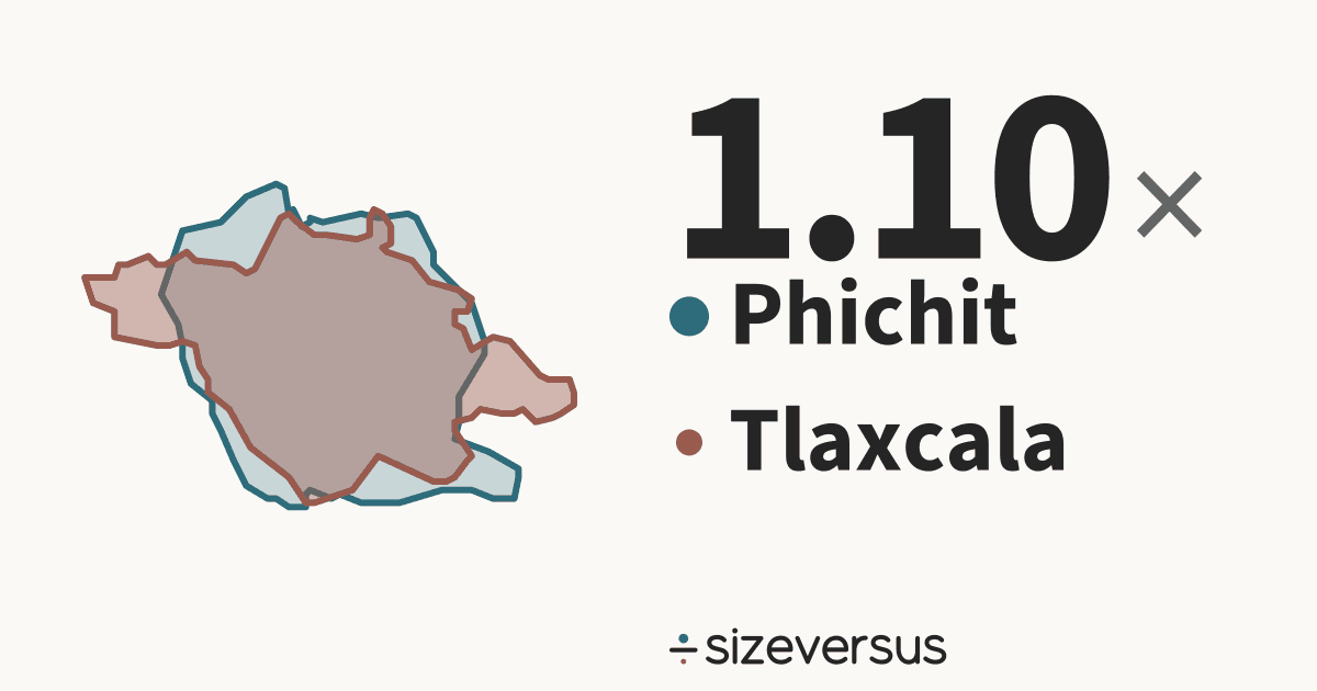
Phichit is 1.10× the size of Tlaxcala
Phichit (province of Thailand) covers about 4,240 km² (1,640 mi²) and Tlaxcala (state of Mexico) about 3,870 km² (1,500 mi²). Below, both outlines are drawn at one scale and centred on each other.
- 4,240km²Phichit
- 3,870km²Tlaxcala
20 km
- Phichit
- Tlaxcala
What fits
- Tlaxcala is 91% of the size of Phichit.
- Phichit is larger by 372 km² (144 mi²), which is 9.6% of the area of Tlaxcala.
- Measured in Belgiums: Phichit is about 0.14, Tlaxcala about 0.13.
How they differ
- Phichit is larger, but Tlaxcala has the larger population: 1.3 million against 532,000, 2.39× as many people.
- Per square kilometre that is 329 in Tlaxcala against 125 in Phichit: Tlaxcala is 2.62× as densely populated.
- Their centres are about 15,600 km apart.
- Together Phichit and Tlaxcala cover 8,120 km², close to the size of Lebanon (10,000 km², 23% bigger).
- The gap between them, 372 km², is about the size of Saint Vincent and the Grenadines (368 km²).
- At Tlaxcala's density, Phichit would have 1.4 million people (it has 532,000). At Phichit's density, Tlaxcala would have 486,000 (it has 1.3 million).
- Tlaxcala's centre is 3.2° of latitude, about 350 km, farther north than Phichit's.
- Phichit is the 50th largest of the 77 provinces of Thailand and covers 0.8% of its area; it is the 38th most densely populated of them.
- Tlaxcala is the 31st largest of the 32 states of Mexico and covers 0.2% of its area; it is the 4th most densely populated of them.
- Tlaxcala lies about 3° of latitude (roughly 354 km) north of Phichit.
- Shared out evenly, each person in Phichit would have about 7,970 m² and each person in Tlaxcala about 3,040 m².
- Laid side by side, Phichit and Tlaxcala would cover 8,120 km², 81% of the size of Lebanon.
- Together they have 1.8 million people, about as many people as North Macedonia.
Side by side
| Phichit | Tlaxcala | |
|---|---|---|
| Is a | ProvinceThailand | StateMexico |
| Area, measured | 4,240 km²1,640 mi² | 3,870 km²1,500 mi² |
| Official area | 4,530 km²Wikidata | 3,990 km²Wikidata |
| Rank by area | 50th of 77in Thailand | 31st of 32in Mexico |
| Population | 532,000Wikidata, 2020 | 1.3 millionWikidata, 2015 |
| Rank by population | 50th of 77in Thailand | 28th of 32in Mexico |
| Density | 125 per km² | 329 per km² |
| Capital | Phichit | Tlaxcala de Xicoténcatl |
| Latitude range | 16°N to 17°N | 19°N to 20°N |
Population: Wikidata 2020 and Wikidata 2015. Official figures: Wikidata (CC0).
- Our measured 4,240 km² is 6.3% below Wikidata's official figure of 4,530 km². Official figures can include inland water or count land that an outline draws differently. This difference is flagged for review.
- Our measured 3,870 km² is 3.0% below Wikidata's official figure of 3,990 km². Official figures can include inland water or count land that an outline draws differently.
Similar in size to Phichit
Similar in size to Tlaxcala
More from the same country
More comparisons
Send it to someone who won’t believe it

Sources and method
- Outlines
- Natural Earth, 1:10m Admin 1 - States, Provinces, public domain
- Boundary
- De facto, as drawn by Natural Earth. A region is drawn whole, every island included; a country is its main territory.
- Area
- Measured on the WGS84 ellipsoid from the full-detail outlines, shown rounded.
- Drawing
- Each outline is projected with an equal-area projection centred on its own centroid, so areas stay true and the two can be laid over each other.
- Data built
- 2026-11-12