State of India
Uttar Pradesh
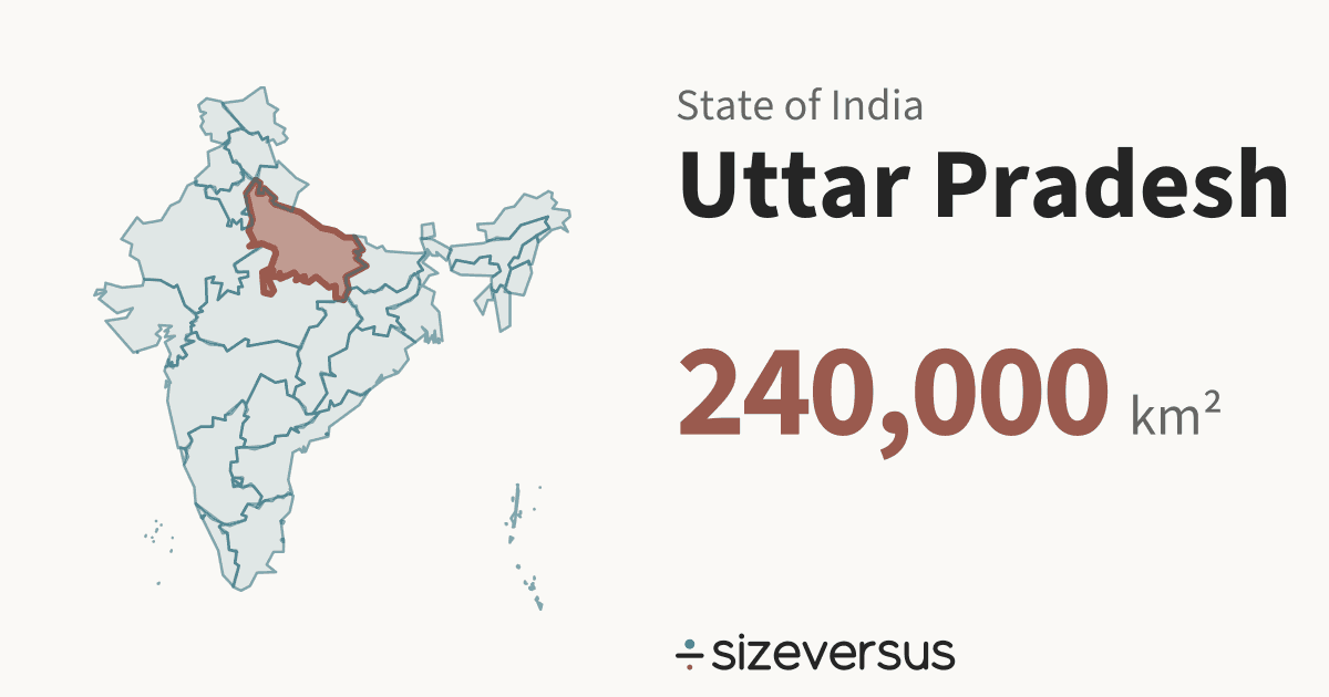
उत्तर प्रदेशUttar Pradesh is a state of India. It covers about 240,000 km² (92,800 mi²), the 4th largest of the 36 states and union territories in Natural Earth’s file for India, and about the same size as Uganda. About 246.3 million people live there (Wikidata, 2025).
200 km
- Uganda
- Uttar Pradesh
Facts
| Area, measured | 240,000 km²92,800 mi² |
|---|---|
| Official area | 243,000 km²Wikidata · agrees with our measure |
| Share of India | 7.6%of the area of the 36 states and union territories |
| Rank by area | 4th of 36states and union territories of India |
| Population | 246.3 millionWikidata, 2025 · the only figure Wikidata has; most units carry 2011 |
| Density | 1,025 people per km² |
| Capital | Lucknow |
| Latitude range | 24°N to 30°N |
| Type | StateIN-UP |
What the numbers say about Uttar Pradesh
- Uttar Pradesh covers 7.6% of the area of India and ranks 1st of 36 by population, against 4th by area.
- It would take 13.1 states and union territories the size of Uttar Pradesh to cover India.
- The largest, Rajasthan, is 1.43× the size of Uttar Pradesh; the smallest, Lakshadweep, is less than 0.1% of it.
- Closest in size within India: Karnataka (192,000 km², 1.25×) and Maharashtra (307,000 km², 1.28×).
- Counted as a country, Uttar Pradesh would be larger than 159 of the 239 countries and territories listed on sizeversus, and would rank 81st by area, between Uganda (242,000 km²) and Ghana (239,000 km²).
- With 246.3 million people it would rank 5th of 238 by population.
- Uttar Pradesh has 1,025 people per km², about the density of Bangladesh, which has 1,252 per km².
- That makes Uttar Pradesh the 7th most densely populated of the 36 states and union territories, 2.56× the average for India (400 per km²).
- Wikidata holds no 2011 figure for Uttar Pradesh; the 2025 figure is the only one it has, so Uttar Pradesh is not counted the same way as the 33 states and union territories that carry 2011.
- On a standard web map (Web Mercator), a place at 27°N is drawn about 1.3× too large in area, so Uttar Pradesh looks bigger there than it is.
- Laid out flat, Uttar Pradesh stretches about 722 km north to south and 744 km east to west.
- Wikidata's official figure of 243,000 km² agrees with our measured area of 240,000 km², to within 2%.
About the same size as
Beside the regions of other countries
The closest region by area and by people in each of the other countries that have regional pages here, within a factor of 2. All 395 regions side by side.
- ChinaAreaGuangxi1.01× · 237,000 km²PeopleGuangdong1.95× · 126.0 million (2020)
- United StatesAreaMichigan0.96× · 250,000 km²Peoplenone within 2×
- BrazilAreaRondônia1.01× · 238,000 km²Peoplenone within 2×
- CanadaAreaNewfoundland and Labrador60% · 403,000 km²Peoplenone within 2×
- AustraliaAreaVictoria1.05× · 228,000 km²Peoplenone within 2×
- MexicoAreaChihuahua0.97× · 248,000 km²Peoplenone within 2×
Where Uttar Pradesh sits in India
All 36 drawn on one equal-area map, so sizes are comparable. Select another to open it.
Compare Uttar Pradesh
- Colorado vs Uttar Pradesh
- Wyoming vs Uttar Pradesh
- Oregon vs Uttar Pradesh
- Michigan vs Uttar Pradesh
- Uganda vs Uttar Pradesh
- Uttar Pradesh vs Ghana
- United Kingdom vs Uttar Pradesh
- Uttar Pradesh vs Romania
- Pakistan vs Uttar Pradesh
- Indonesia vs Uttar Pradesh
- Uttar Pradesh vs Guangxi
- Uttar Pradesh vs Minnesota
- Uttar Pradesh vs Utah
- Uttar Pradesh vs Idaho
Share this outline

Sources and method
- Outline
- Natural Earth, 1:10m Admin 1 - States, Provinces, public domain
- Boundary
- De facto, as drawn by Natural Earth.
- Area
- Measured on the WGS84 ellipsoid from the full-detail outline, shown rounded. The region’s whole area is counted, every island included.
- Official figures
- Area, population and capital from Wikidata (CC0), fetched 2026-11-12
- Population
- Wikidata, 2025. India’s units share the 2011 figures where Wikidata has them; the year is shown wherever the figure is.
- Matching
- Countries come from Natural Earth’s country file. Places whose status is contested and dependencies are never used as automatic matches. A region under 2,500 km² is matched against the small countries and island nations.
- Data built
- 2026-11-12