State of Mexico
Campeche
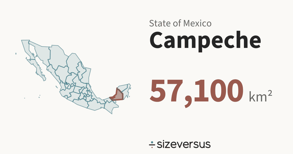
Campeche is a state of Mexico. It covers about 57,100 km² (22,100 mi²), the 18th largest of the 32 states in Natural Earth’s file for Mexico, and about the same size as Togo. About 928,000 people live there (Wikidata, 2020).
100 km
- Campeche
- Togo
Facts
| Area, measured | 57,100 km²22,100 mi² |
|---|---|
| Official area | 57,500 km²Wikidata · agrees with our measure |
| Share of Mexico | 2.9%of the area of the 32 states |
| Rank by area | 18th of 32states of Mexico |
| Population | 928,000Wikidata, 2020 · the only figure Wikidata has; most units carry 2015 |
| Density | 16 people per km² |
| Capital | San Francisco de Campeche |
| Latitude range | 18°N to 21°N |
| Type | StateMX-CAM |
What the numbers say about Campeche
- Campeche covers 2.9% of the area of Mexico and ranks 30th of 32 by population, against 18th by area.
- It would take 34.3 states the size of Campeche to cover Mexico.
- The largest, Chihuahua, is 4.34× the size of Campeche; the smallest, Mexico City, is 2.4% of it.
- Closest in size within Mexico: Sinaloa (57,700 km², 1.01×) and Michoacán (58,900 km², 1.03×).
- Counted as a country, Campeche would be larger than 114 of the 239 countries and territories listed on sizeversus, and would rank 126th by area, between Latvia (64,600 km²) and Togo (56,900 km²).
- With 928,000 people it would rank 162nd of 238 by population.
- Campeche has 16 people per km², about the density of Finland, which has 17 per km².
- That makes Campeche the 28th most densely populated of the 32 states, 26% of the average for Mexico (61 per km²).
- Wikidata holds no 2015 figure for Campeche; the 2020 figure is the only one it has, so Campeche is not counted the same way as the 24 states that carry 2015.
- Campeche lies at 19°N, close to the equator, where a standard web map (Web Mercator) is nearly true to size: it inflates area by only about 1.1×.
- Laid out flat, Campeche stretches about 336 km north to south and 365 km east to west.
- Wikidata's official figure of 57,500 km² agrees with our measured area of 57,100 km², to within 2%.
Beside the regions of other countries
The closest region by area and by people in each of the other countries that have regional pages here, within a factor of 2. All 395 regions side by side.
- ChinaAreaNingxia1.10× · 52,100 km²Peoplenone within 2×
- United StatesAreaWest Virginia0.91× · 62,700 km²PeopleSouth Dakota1.05× · 887,000 (2020)
- IndiaAreaHimachal Pradesh1.03× · 55,400 km²PeopleChandigarh88% · 1.1 million (2011)
- GermanyAreaLower Saxony1.20× · 47,600 km²PeopleSaarland0.92× · 1.0 million (2022)
- FranceAreaGrand Est1.00× · 57,400 km²PeopleRéunion (France)1.05× · 881,000 (2022)
- ItalyAreanone within 2×PeopleUmbria1.05× · 882,000 (2019)
- SpainAreaAragon1.20× · 47,600 km²PeopleAsturias0.92× · 1.0 million (2024)
- JapanAreaHokkaido (Japan)73% · 78,800 km²PeopleAkita0.98× · 946,000 (2021)
- BrazilAreaParaíba1.01× · 56,500 km²PeopleAcre1.12× · 830,000 (2022)
- CanadaAreaNova Scotia1.04× · 55,100 km²PeopleNova Scotia0.96× · 969,000 (2021)
- AustraliaAreaTasmania (Australia)84% · 68,100 km²PeopleTasmania (Australia)1.72× · 540,000 (2020)
- ThailandAreanone within 2×PeopleNakhon Pathom1.01× · 921,000 (2020)
Where Campeche sits in Mexico
All 32 drawn on one equal-area map, so sizes are comparable. Select another to open it.
Compare Campeche
- Grand Est vs Campeche
- Campeche vs Togo
- Campeche vs Croatia
- Ireland vs Campeche
- Campeche vs Denmark
- Campeche vs Fiji
- Tasmania (Australia) vs Campeche
- Campeche vs Nova Scotia
- Campeche vs Ningxia
- Campeche vs Paraíba
- West Virginia vs Campeche
- Campeche vs Himachal Pradesh
- Campeche vs Aragon
- Hokkaido (Japan) vs Campeche
- Campeche vs Lower Saxony
- Campeche vs Akita
- Campeche vs Nakhon Pathom
- Campeche vs Rio Grande do Norte
- Campeche vs Uttarakhand
- Campeche vs Punjab
- Campeche vs Wakayama
Share this outline

Sources and method
- Outline
- Natural Earth, 1:10m Admin 1 - States, Provinces, public domain
- Boundary
- De facto, as drawn by Natural Earth.
- Area
- Measured on the WGS84 ellipsoid from the full-detail outline, shown rounded. The region’s whole area is counted, every island included.
- Official figures
- Area, population and capital from Wikidata (CC0), fetched 2026-11-12
- Population
- Wikidata, 2020. Mexico’s units share the 2015 figures where Wikidata has them; the year is shown wherever the figure is.
- Matching
- Countries come from Natural Earth’s country file. Places whose status is contested and dependencies are never used as automatic matches. A region under 2,500 km² is matched against the small countries and island nations.
- Data built
- 2026-11-12