Province of Thailand
Sukhothai
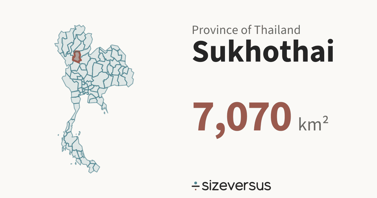
Sukhothai is a province of Thailand. It covers about 7,070 km² (2,730 mi²), the 28th largest of the 77 provinces in Natural Earth’s file for Thailand, and 1.24× the size of Brunei. About 588,000 people live there (Wikidata, 2020).
50 km
- Sukhothai
- Brunei
Facts
| Area, measured | 7,070 km²2,730 mi² |
|---|---|
| Official area | 6,600 km²Wikidata · 7.1% below our measure |
| Share of Thailand | 1.4%of the area of the 77 provinces |
| Rank by area | 28th of 77provinces of Thailand |
| Population | 588,000Wikidata, 2020 |
| Density | 83 people per km² |
| Capital | Sukhothai Thani |
| Latitude range | 17°N to 18°N |
| Type | ProvinceTH-64 |
What the numbers say about Sukhothai
- Sukhothai covers 1.4% of the area of Thailand and ranks 43rd of 77 by population, against 28th by area.
- It would take 72.8 provinces the size of Sukhothai to cover Thailand.
- The largest, Chiang Mai, is 3.22× the size of Sukhothai; the smallest, Samut Songkhram, is 5.9% of it.
- Closest in size within Thailand: Sa Kaeo (7,080 km², 1.00×) and Prachuap Khiri Khan (6,930 km², 1.02×).
- Counted as a country, Sukhothai would be larger than 70 of the 239 countries and territories listed on sizeversus, and would rank 170th by area, between Puerto Rico (9,010 km²) and French Southern and Antarctic Lands (6,990 km²).
- With 588,000 people it would rank 170th of 238 by population.
- Sukhothai has 83 people per km², about the density of Kenya, which has 83 per km².
- That makes Sukhothai the 57th most densely populated of the 77 provinces, 65% of the average for Thailand (129 per km²).
- Sukhothai lies at 17°N, close to the equator, where a standard web map (Web Mercator) is nearly true to size: it inflates area by only about 1.1×.
- Laid out flat, Sukhothai stretches about 126 km north to south and 92 km east to west.
- Our measured 7,070 km² is 7.1% above Wikidata's official figure of 6,600 km². Official figures can include inland water or count land that an outline draws differently. This difference is flagged for review.
About the same size as
Beside the regions of other countries
The closest region by area and by people in each of the other countries that have regional pages here, within a factor of 2. All 395 regions side by side.
- ChinaAreaShanghai1.05× · 6,750 km²Peoplenone within 2×
- United StatesAreaDelaware1.37× · 5,170 km²PeopleWyoming1.02× · 577,000 (2020)
- IndiaAreaAndaman and Nicobar Islands0.99× · 7,110 km²PeopleDadra and Nagar Haveli and Daman and Diu1.00× · 586,000 (2011)
- GermanyAreanone within 2×PeopleBremen85% · 693,000 (2022)
- FranceAreaCorsica (France)82% · 8,670 km²PeopleRéunion (France)67% · 881,000 (2022)
- ItalyAreaFriuli-Venezia Giulia0.96× · 7,340 km²PeopleBasilicata1.04× · 563,000 (2019)
- SpainAreaBasque Country1.00× · 7,060 km²PeopleCantabria0.99× · 592,000 (2024)
- JapanAreaKochi1.00× · 7,090 km²PeopleTottori1.07× · 550,000 (2021)
- BrazilAreaFederal District1.22× · 5,790 km²PeopleRoraima0.92× · 637,000 (2022)
- CanadaAreaPrince Edward Island1.23× · 5,730 km²PeopleNewfoundland and Labrador1.15× · 511,000 (2021)
- AustraliaAreanone within 2×PeopleTasmania (Australia)1.09× · 540,000 (2020)
- MexicoAreaColima1.20× · 5,880 km²PeopleBaja California Sur0.92× · 637,000 (2010)
Where Sukhothai sits in Thailand
All 77 drawn on one equal-area map, so sizes are comparable. Select another to open it.
Compare Sukhothai
- Sukhothai vs Brunei
- Sukhothai vs Cyprus
- Solomon Islands vs Sukhothai
- Montenegro vs Sukhothai
- Sukhothai vs Prince Edward Island
- Sukhothai vs Shanghai
- Sukhothai vs Federal District
- Sukhothai vs Delaware
- Andaman and Nicobar Islands vs Sukhothai
- Sukhothai vs Colima
- Sukhothai vs Basque Country
- Corsica (France) vs Sukhothai
- Kochi vs Sukhothai
- Friuli-Venezia Giulia vs Sukhothai
- Wyoming vs Sukhothai
- Sukhothai vs Dadra and Nagar Haveli and Daman and Diu
- Sukhothai vs Cantabria
Share this outline

Sources and method
- Outline
- Natural Earth, 1:10m Admin 1 - States, Provinces, public domain
- Boundary
- De facto, as drawn by Natural Earth.
- Area
- Measured on the WGS84 ellipsoid from the full-detail outline, shown rounded. The region’s whole area is counted, every island included.
- Official figures
- Area, population and capital from Wikidata (CC0), fetched 2026-11-12
- Population
- Wikidata, 2020. Thailand’s units share the 2020 figures where Wikidata has them; the year is shown wherever the figure is.
- Matching
- Countries come from Natural Earth’s country file. Places whose status is contested and dependencies are never used as automatic matches. A region under 2,500 km² is matched against the small countries and island nations.
- Data built
- 2026-11-12