Asia · Western Asia
Turkish Republic of Northern Cyprus
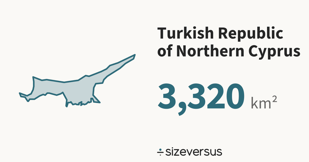
Turkish Republic of Northern Cyprus covers about 3,320 km² (1,280 mi²), the 179th largest of the 246 places listed here. That is close to French Polynesia, at about 3,340 km².
- 3,320km²Area, main territory
- 489,000Population
- 0.11In Belgiums
The boundary or political status of this area is contested. Size Versus draws the Natural Earth de facto outline and takes no position on it.
50 km
- Turkish Republic of Northern Cyprus
Facts
| Area, main territory | 3,320 km²1,280 mi² |
|---|---|
| Official area | 3,360 km²Wikidata · agrees with our measure |
| In Belgiums | 0.11 |
| Capital | North Nicosia |
| Population | 489,000Wikidata, 2024 |
| Density | 147 people per km² |
| Latitude range | 35°N to 36°N |
| In other languages | República Turca del Norte de Chipre Español · Türkische Republik Nordzypern Deutsch · Chypre du Nord Français · República Turca do Chipre do Norte Português · 北キプロス・トルコ共和国 日本語 · 北塞浦路斯土耳其共和国 中文 · 북키프로스 한국어 |
| Continent | Asia#47 of 51 countries by area |
What the numbers say about Turkish Republic of Northern Cyprus
- Russia, the largest place listed, is 5,115× the size of Turkish Republic of Northern Cyprus.
- At 147 people per km², Turkish Republic of Northern Cyprus is the 42nd most densely populated of the 185 places over 1,000 km²; the median is 72 per km².
- On a standard web map (Web Mercator), a place at 35°N is drawn about 1.5× too large in area, so Turkish Republic of Northern Cyprus looks bigger there than it is.
- Laid out flat, Turkish Republic of Northern Cyprus's main territory stretches about 77 km north to south and 180 km east to west.
- Wikidata's official figure of 3,360 km² agrees with our measured area of 3,320 km², to within 2%.
How Turkish Republic of Northern Cyprus measures up
Turkish Republic of Northern Cyprus holds 0.0% of the land area and 0.0% of the people of the 51 countries listed for Asia. In Western Asia it is the 18th largest of 19.
| Where it ranks | Figure | Position |
|---|---|---|
| Area | 3,320 km² | 178th of 239 |
| Population | 489,000 | 173rd of 237 |
| Density | 147 per km² | 42nd of 185 |
| Farthest north | 35.3°N | 68th of 212 |
| Compared with | Its area | Turkish Republic of Northern Cyprus is |
|---|---|---|
| Belgium | 30,700 km² | 0.11× its size |
| United Kingdom | 244,000 km² | 0.01× its size |
| Germany | 358,000 km² | 0.01× its size |
| Japan | 374,000 km² | 0.01× its size |
| France | 548,000 km² | 0.01× its size |
| India | 3,151,000 km² | 1 in 949 its size |
| Brazil | 8,473,000 km² | 1 in 2,552 its size |
| United States | 9,447,000 km² | 1 in 2,846 its size |
| Russia | 16,980,000 km² | 1 in 5,115 its size |
Where Turkish Republic of Northern Cyprus sits
- Turkish Republic of Northern Cyprus's centre lies at 35.3°N, 33.6°E, in the northern and eastern hemispheres, about 3,920 km from the equator.
- Its main territory spans 35°N to 36°N, about 80 km from its southern edge to its northern.
Closest neighbours, by distance between centres
On the same latitude, elsewhere in the world
If Turkish Republic of Northern Cyprus had other densities
- At Bangladesh's density of 1,252 people per km², Turkish Republic of Northern Cyprus would have 4.2 million people. It has 489,000.
- At Canada's density of 3.7 people per km², Turkish Republic of Northern Cyprus would have 12,000 people. It has 489,000.
- At the median density of the places listed, 72 per km², it would have 240,000.
About the same size as
Largest in Asia
- China9,375,000 km²
- India3,151,000 km²
- Kazakhstan2,714,000 km²
- Saudi Arabia1,922,000 km²
- Indonesia1,880,000 km²
- Turkish Republic of Northern Cyprus#47 · 3,320 km²
Compare Turkish Republic of Northern Cyprus
- Cape Verde vs Turkish Republic of Northern Cyprus
- South Georgia and the South Sandwich Islands vs Turkish Republic of Northern Cyprus
- French Polynesia vs Turkish Republic of Northern Cyprus
- Turkish Republic of Northern Cyprus vs Samoa
- United Kingdom vs Turkish Republic of Northern Cyprus
- Italy vs Turkish Republic of Northern Cyprus
- Germany vs Turkish Republic of Northern Cyprus
- Turkish Republic of Northern Cyprus vs Luxembourg
Share this outline

Sources and method
- Outline
- Natural Earth, 1:10m Admin 0 - Countries, public domain
- Boundary
- De facto, as drawn by Natural Earth.
- Area
- Measured on the WGS84 ellipsoid from the full-detail outline, shown rounded
- Official figures
- Area, population and capital from Wikidata (CC0), fetched 2026-11-11
- Population
- Wikidata, 2024; covers the whole country, overseas territory included
- Data built
- 2026-11-11